 |
|
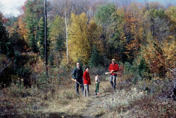
“Looking for a bird” at the end of the causeway, west shore of Bella Lake, 1964 (J. David Burgess)
|
One of the later areas to be developed with cottages was the western shore of Bella Lake, primarily due to the lack of road access until the 1970s.
Settlers and Logging
Many early settlers of the later 1870s did attempt to farm their lands after receiving their land grants, but the terrain was rocky, hilly, and rugged and not conducive to farming. The road that served the settlers was the Sinclair Road, which ran northeast across Sinclair Township, up the west side of Bella Lake to the first Antioch location and northwards from there.
Logging was more successful. After the settlers left, the logging companies such as the Muskoka Wood Manufacturing Company (owned by R. J. Hutcheson) logged the lands on the west side of Bella Lake in the late 1920s. Their north logging camp was at Crawford’s Bay (also known as Lumberman’s Bay) on Bella Lake. It was based on the old Sinclair Road, which was used as a cadge team road (for the transportation of their supplies). Later, lumberman Edgar Brook (Brookie) also built a tote road to carry supplies through this property on the west side of Bella Lake and up to his logging camps on the East River.
Surveying for Cottage Lots
Much of the land on the western shore was owned by the Field family, mainly for lumbering, including Lot 7, Concession 8 (Crown Grant by King George V to Thomas D. Field, December 1, 1901). Stewart L. Burgess and his wife Helen (Kay) Burgess, then owners of Stevenson’s Point (a Field property), purchased Lot 7, Concession 8 from Robert A. Field on September 1, 1958, following the “Gaza Strip” incident (on the causeway), in order to provide land for their four children. In October of 1969, the Burgess children created four lakefront lots (Survey BR-1602) on Bella Lake (and backlots due to the split of the land by the township-owned Old Sinclair Road). The Old Sinclair Road, a hilly and winding route, had been used by the early settlers to access their lands and camps. In 1969 this “road” was an overgrown path in the bush, at which time the Burgess bothers hired a surveyor to officially locate and pin it. The township required that it be shown on the survey plan. However, access to the property continued to be by water or walking in from the bridge for a few more years.
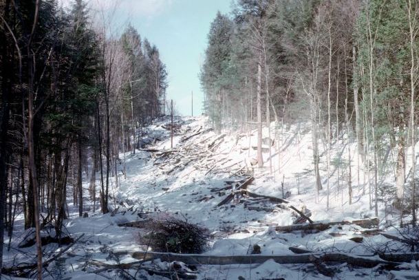
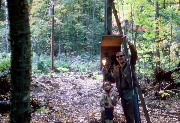
In the winter of 1970, David and his younger brother Bill Burgess hired a contractor to build the hydro line on this shore, connecting it to the line at the causeway. With the coming of electricity, Bill Burgess, the first cottager and later resident, built his cottage. Without road access, all of his building materials were barged across Bella Lake from Buck Island Point (Stevenson’s Point) to his building site on the western shore. In December 1971, the District of Muskoka and the Township of Lake of Bays were formed and the unorganized Township of Sinclair became a ward of the Township of Lake of Bays, a major change for the area that also affected lot development.
 |
 |
|
| Putting in the hydro line, west shore of Bella Lake (J. David Burgess) |
Hydro comes to the west shore, 1970 (J. David Burgess) |
A Road Across the Causeway
In the fall of 1972, David and Virginia Burgess purchased from Hugh Feasby Lot 7, Concession 7 on the north side of Rebecca Lake, which included the causeway. The township granted permission to the Burgesses to extend Caroline Street (Fieldale Road), after the new bridge was built, to the causeway. David Burgess next extended this road over the causeway to their properties. In 1974 David and Virginia Burgess dedicated the causeway portion back to the township, and it was included in the township’s public road and maintenance system. At last there was road access connecting the western shore of Bella Lake and northern shore of Rebecca Lake beyond the causeway. David and Virginia Burgess began construction of their home in 1989 and became full-time residents in 1990.
Although surveyed in 1969, the Old Sinclair Road wasn’t opened as the Colonization Road until the 1980s. It remains a hilly and winding route. One can only imagine how the settlers tried to farm and navigate this rocky land; many did not remain, departing for gentler farming communities. Today, three members of the Burgess family still own four properties on the Bella western shore. Other lots were created over the years and sold to various cottagers.
 |
 |
|
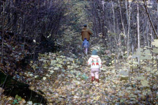
| View of Bella Lake from the high point on the Old Sinclair (Colonization) Road, ca. 1970s (Burgess Family) | A walk on the Old Sinclair or the tote road, ca. 1970s (Burgess Family) |
Sources:
Burgess, Bill, personal communications, November 2018.
Burgess, David, “Fieldale Road” (Presentation at the Lake of Bays Library, Dwight, October 2013).


