


Points of Bella and Rebecca
 |
|
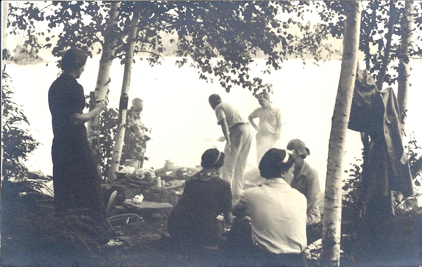
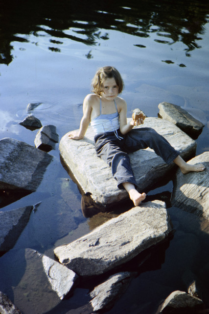
Picnic at Breakfast Point, 1940 (Barbara Paterson Collection, “Matt 1940” photo) |
Points of land have lure that even the gentlest shoreline landing, however protected, cannot command. “Indian Point” on Rebecca Lake – now Pine Point, long a cottage property – was so named because of the arrow or spear heads found on shore, evidence of an early, and regular, campsite for Indigenous travellers.
Perhaps the perspective was useful; likely the lake breeze was also welcome. Whatever the reasons, points continued to be chosen for the camps and cottages that followed in the wake of settlers. A stone fireplace on Stevenson’s Point, built by some guest on the lakes and frequented by many, existed long before the point became a cottage property. Several early camps – Bailey’s on Rebecca Lake and Fleming’s on Bella – were built on or nestled behind rocky, pine points. Norway Point, now part of the Antioch Conservation Area, was one of many sites where pines were planted for reforestation in the 1940s and 1950s.
“Goldenrod Point,” to the west of the entrance to Swain’s Bay, Bella Lake, part of Fleming’s camp and now a cottage property, is also known as “Sunset Point” for its view over the lake toward the west. The corresponding point to the east came to be called “Breakfast Point” – a frequent picnic excursion, along a path through the woods called the Leatherwood Trail, for guests of Camp Billie Bear. Although cottage lots now line the shore, the name is retained by Leatherwood Lane, a cottage access loop off the Bella Shores Road.
 |
 |
|
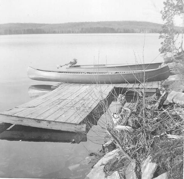
| Canoe and tin boat at blueberry dock, Buck Island Point, 1956 (Wendy Burgess) |
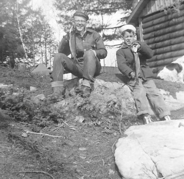
David and Bill Burgess with trout, Buck Island Point, 1956 (Wendy Burgess) |
Twin Bays on Twin Lakes – Hutcheson and Swain’s
Rebecca and Bella Lakes each have one large bay all but set apart by a narrow entrance channel. Hutcheson Bay, on Rebecca, was the site of the lakes’ first actual “cottage,” as well as the first cottage development plan, although the latter did not succeed at the time. The bay was named for the Hutcheson family, who purchased lots that included a sawmill and lumber camp site for a summer camp in 1906.
The land surrounding Swain’s Bay on Bella Lake, named for settler William Swain, was likewise used more for lumber interests than for settlement. Swain had a homestead and farm on Lots 16 and 17, Concession B on the Bobcaygeon line, a portion of which backed onto the bay. However, much of the land to the east of the bay, now owned by Hutcheson Forest Industries, was acquired early in the century by the Muskoka Wood Manufacturing Company. The western shore, on lots owned by the Fleming family, has been divided for cottages. A favourite haunt of loons, the bay was the site of a float plane crash in the early 1970s.
Kells Bay, Rebecca Lake
Named for Edward and Eliza Kells, who acquired the lot at the southern tip of Rebecca Lake from settler William Nelson in 1898, Kells Bay was often the setting-out point for travellers on Rebecca and Bella Lakes before passable roads were extended around the shores. In early years into the 1920s, guests at Camp Billie Bear were rowed up Rebecca Lake, through the narrows, and across Bella Lake to the camp. Limberlost Lodge arranged visits to Bella Beach for its guests, with the launch point at Kells Landing.
Crawford Bay, Bella Lake
One of several lumber camps of R. J. Hutcheson’s Muskoka Wood Manufacturing Company was located on Crawford Bay, also called Lumberman’s Bay. The name refers to G. H. Crawford, who had taken up Lots 6 and 7, Concession 9, surrounding the bay. Crawford did not farm or settle on his lots, which were among those acquired by Muskoka Wood in the early 1900s.
 |
 |
|
|
Kells Bay, Rebecca Lake, from Mansell’s point, looking east toward Kells Landing, ca. 1940s. The point was all grass as it was the farmer’s pasture. (Wendy Kimmel) |
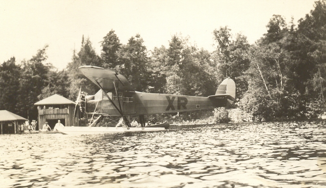
“The quickest way to reach Camp Billie Bear,” postcard from the 1930s of Billie Bear Bay with boathouses and Tom Higgins’ plane. Tom was the brother of Marion Hill of Limberlost and ran an air service based on Solitaire and Peninsula Lakes during the 1930s. (Barbara Paterson Collection, Billie Forrest and Olive Corcoran) |
Billie Bear Bay
In the 1920s and 1930s, Camp Billie Bear’s boathouses sat along the bay at the northeast edge of Bella Lake. On the far shore, for a number of years, were the remains of derelict rowboats once used to ferry guests from Kells Landing to the Camp. Another feature of the shoreline from the 1940s into the 1970s was the bright yellow canoe once owned by guide Geoff Isaac, bequeathed to the Thompson and Clifford families when they purchased his cabin at the end of the bay. Billie Bear Bay was the float plane base of Huntsville Air Services in the 1970s and 1980s, operated by proprietors Dave and Dianne Gronfors.
In the early 1990s, the eastern shoreline of Lot 20, part of Andrew Hart’s original land grant, was subdivided and sold for cottage lots. Billie Bear retains 12 acres of Lot 20 on the lakeshore as well as the entire back Lot 21 of the Hart property.
Islands of Bella Lake
Betty Hill, the daughter of Mabel (Hart) and Henry Norton Hill, was christened in 1922 on the island that has since borne her name. A rite of passage for the children of generations of Billie Bear guests and owners has been that first solo paddle or swim to Betty’s Island. The island is Crown land and is cared for by the Bella-Rebecca Community Association.
 |
 |
|
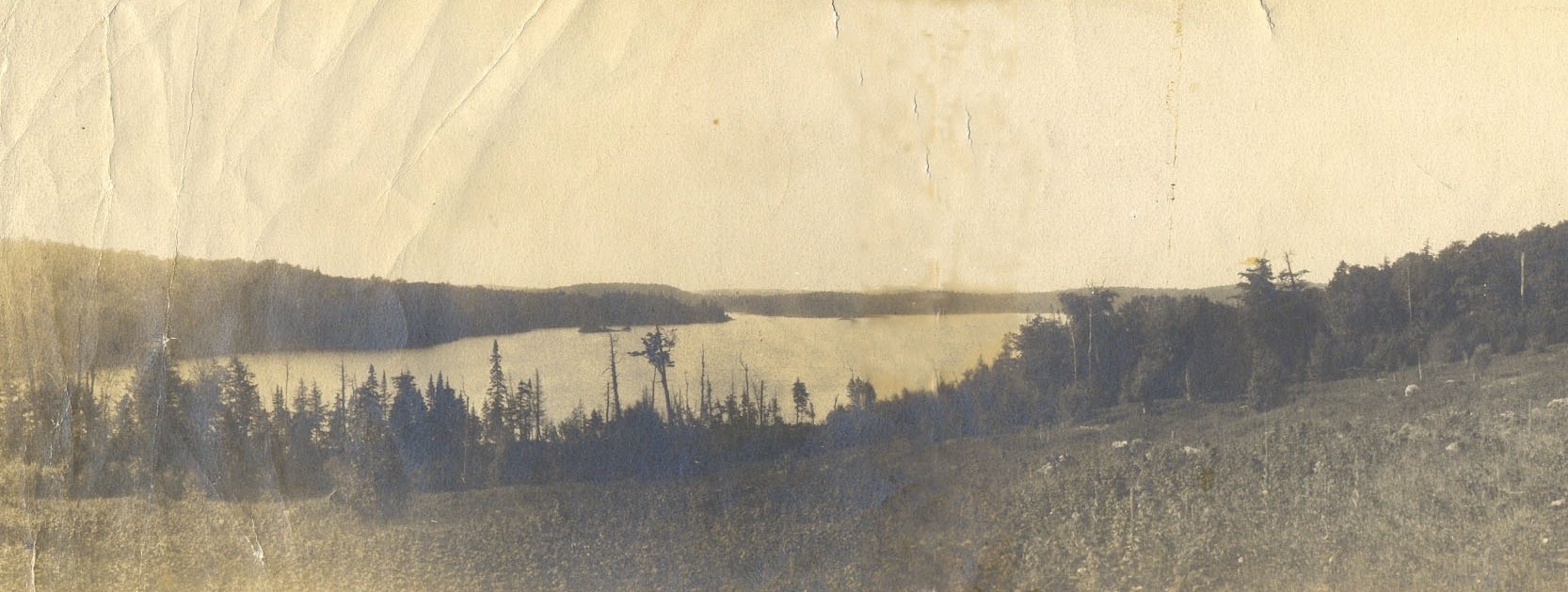
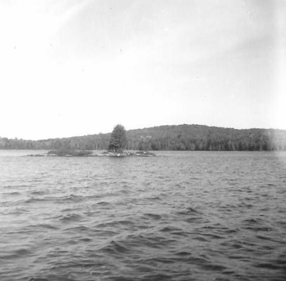
| A panorama of a bit of Billie Bear Bay and the east shore of Bella Lake, Betty’s Island, the entrance to Swain’s Bay, and a portion of the south shore, early 1900s. (Barbara Paterson Collection) | Buck Island, Bella Lake, 1962. The trees have grown! (Wendy Burgess) |
Buck Island has likewise been a swimming, canoeing, and picnicking destination for cottagers on the shore of Buck Island Point. Glacier activity left interesting rock formations beneath the water – a stepped ridge from the island to the shore and a flat shelf on the other side extending into the lake.
Islands of Rebecca Lake
Marked as “Fairhope” on topographical maps, Robin Island is the largest island on the lakes – although too small to support a cottage. The island was a summer campsite for several years and is privately owned.
 |
 |
|
|
Looking northwest toward Robin Island and north shore of Rebecca, Linda Mansell Housser and Elsie Mansell, 1951 (Wendy Kimmel) |
Picnic at Clam Island, Wendy, 1958 (Wendy Kimmel) |
Tea Island – just offshore of the causeway – was so named because of the Labrador tea that traditionally grew there.
Clams and crayfish were once prolific in Rebecca and Bella Lakes, but the level of calcium has declined over recent years, causing shellfish to die out. Clam Island in Rebecca Lake was once noted for the broken clamshells that littered the rocks, remnants of a meal for osprey, otter, and raccoon.